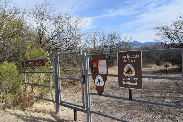
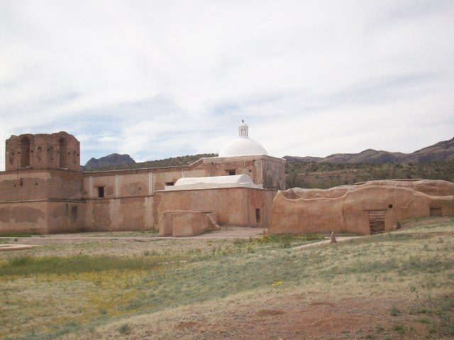
The 1200 mile long Juan Bautista de Anza National Historic Trail commemorates the 1775-76 expedition led by Juan Bautista de Anza to establish a mission and presidio or garrison – in what is now San Francisco, California – during Spanish colonial rule. Juan Bautista de Anza led more than 240 men, women, and children along with their belongings, horses, pack animals, and heads of cattle from San Miguel de Horcasitas Presidio in what is now the state of Sonora, Mexico to what is now the San Francisco Bay Area. The journey took six months to complete. The Juan Bautista de Anza National Historic Trail is managed by the National Park Service and in the U.S. the trail starts in modern day Nogales, Arizona and ends in modern day San Francisco, California. Recently, I followed a small section of the historic trail that parallels and crosses the Santa Cruz River in Arizona from Tumacacori to Tubac.

Juan Bautista de Anza was born in Fronteras Presidio, Sonora in 1735 or 1736; de Anza became Captain of the Presidio of Tubac in 1774; and, that same year he travelled from Tubac to Mission San Gabriel and Monterrey Presidio in California to establish a direct land route to Alta California. Juan made a second journey to Alta California following the same route in 1775-76. The main reason why Spanish authorities wanted to establish a new settlement in San Francisco was to halt the advancement of Russian settlements in Alta California – the southernmost Russian settlement was Fort Ross.
After he returned from his second journey to Alta California, Juan de Anza was named Governor of New Mexico. He died in 1788 in the town of Arizpe in what is now the Mexican state of Sonora. Even though the trail is named after Juan Bautista de Anza, there is no doubt in my mind that his success in finding a safe land route could not have been possible without the help of Native Americans as guides, interpreters, and their keen knowledge of the land and its resources.
The Anza Trail was designated as a National Historic Trail in 1990. It traverses five counties in Arizona and 14 counties in California. I only walked 3.5 miles of the trail in Santa Cruz County; nonetheless, I think this small section is a great place to get an idea of what the expedition members encountered on the road. The Santa Cruz River offered the expedition a reliable source of water and relatively easy terrain on which to travel.
The Santa Cruz River is the only river in the United States that crosses an international border twice; it originates in the Canelo Hills of southeastern Arizona then flows south to Mexico, makes a U-turn after a few miles, and returns to Arizona near Nogales. Currently, the Santa Cruz River is dry most of the year except during the monsoon season when it is common to see surface water on the river bed. The section of the river between Tumacacori and Tubac is effluent dependent. The treated wastewater comes from the Nogales International Wastewater Treatment Plant – I mention more details about the wastewater treatment plant and Tumacacori Mission in a previous blog post published in April of 2014.

Despite the source of the surface water I find this section of the Anza Trail appealing since the cottonwood-willow gallery and the mesquite bosque provide a serene environment in which to contemplate the history of the region and enjoy the wildlife that depends on the riparian area. Riparian areas are extremely important for local and migrating wildlife species such as birds; riparian areas are also threatened ecosystems. In Arizona, it is estimated that less than 10% of the state’s original riparian habitat remains intact. According to the Arizona Riparian Council, approximately 60-75% of the state’s resident wildlife species depend on riparian areas to sustain their populations; yet, riparian areas occupy less than 0.5% of Arizona’s total land area.
The Santa Cruz River riparian area is recognized as an Important Bird and Biodiversity Area. A testament to the importance of this area for the biological diversity of the region is the recent rediscovery of the Gila topminnow. The Gila topminnow is 1-2 inch Endangered native fish. This native fish was last seen in the Upper Santa Cruz River in 2005, and after a 10 year absence the native fish species was reported during the most recent fish survey in 2015. The re-appearance of Gila topminnow in the river is possibly due to incoming flash floods from Sonoita Creek – a tributary of the Santa Cruz River where the endangered fish can still be found.
I personally did not see any fish this last time I hiked the trail, but I do remember seeing fish in the early 2000’s. The Anza trail between Tumacacori and Tubac crosses the river a couple of times, the crossing is made easier by pedestrian foot bridges provided by the Arizona Anza Trail Coalition. I hiked the trail in mid-January and possibly due to recent winter rains or maybe as a result of the last monsoon season – a portion of the trail before Clark Crossing – and possibly part of the trail located on private land all but disappeared. On that particular section of the river, a good amount of wooden debris had accumulated as well as a good amount of trash. After what felt like a leisurely walk by the river and across foot bridges the time had come to get wet and muddy feet – I enjoyed it since it provided me with an opportunity to wonder what the Anza expedition had encountered along this stretch of the river. The section of the trail from Clark Crossing to Tubac is well maintained and it’s an easy walk.
Tubac was Camp #14 of Anza’s expedition and it’s where Anza gathered all of the future settlers, made final preparations, and set out in October of 1775 as a complete expedition. Tubac had been settled by Pima Native Americans for centuries prior to the arrival of Spanish colonists. The Presidio of Tubac was founded in 1752 in response to an uprising of the local Pimas. The old presidio walls are mostly gone but portions of it as well as the presidio’s foundation can still be seen at Tubac Presidio State Historic Park – which happens to be Arizona’s 1st state park.
The town of Tubac has experienced many changes and rebirths throughout the centuries most recently as a hub for artisans and tourists in Southern Arizona; yet old Tubac where Tubac Presidio State Historic Park is located retains its small southwestern town charm. A visit to the State Historic Park and its surroundings is a visual treat since one can get a sense of the different cultural influences in the region ranging from Native American, Spanish, Mexican, and finally Anglo-European.
Tumacacori National Historical Park, the Anza Trail, the Santa Cruz River, and Tubac Presidio State Park are all easily accessible via Interstate 19 which connects Nogales, Arizona on the border with Mexico to Tucson, Arizona only about 60 miles away making it one of the shortest Interstates in the U.S and also a unique one since distances are given in meters and kilometers unlike other Interstates, so the next time you travel on I-19 or if you are ever in this area remember to look East and think about all the history and biodiversity present along this corridor.


