I have been fortunate enough to visit El Pinacate Biosphere Reserve on several occasions; all of them in the summertime when the intense heat might be a deterrent for some visitors, yet despite the high temperatures the opportunity to explore new corners of the biosphere reserve enraptures me every single time. La Reserva de la Biosfera El Pinacate y Gran Desierto de Altar (El Pinacate hereinafter) is located in Northwestern Sonora, Mexico. Mexican Federal Highway 2, only a few meters from the U.S.-Mexico border, defines the northern boundary of the 714,566 hectare natural protected area. El Pinacate in Mexico along with Organ Pipe Cactus National Monument and Cabeza Prieta National Wildlife Refuge in Southwestern Arizona protect a huge area of the Sonoran Desert at a binational scale.
El Pinacate was established in 1993 by the Mexican federal government; although, the land is privately owned by several ejidatarios. Since its establishment it has acquired international recognition by being included in UNESCO’s World Network of Biosphere Reserves, part of the Man and Biosphere Program, and in 2013 it was inscribed on the list of World Heritage Sites. Additionally, 39 hectares of the Rio Sonoyta, the Agua Dulce reach, are included on the Ramsar Convention’s (The Convention on Wetlands) List of Wetlands of International Importance.
Agua Dulce Reach – Rio Sonoyta – mostly dry due to prolonged drought and excessive human consumption.
Sonoyta pupfish (native) and mosquito fish (invasive). Longfin dace haven’t been captured/observed in recent years.
Remaining puddles along the Sonoyta River where fish and Sonoyta mud turtles cling to survival.
The beautifully built Schuk Toak visitor’s center is a good place to start your visit at El Pinacate. The visitor center offers interactive displays were you can learn about the geology of the area, its biodiversity, as well as learn about the ancient inhabitants and their cosmology. Personally, it was very interesting to learn about Juan Carvajales, the last ‘pinacateño’ who lived on the land in the early 20th century. You can also learn about the ancient salt trails. The salt trails are ancient trading routes from tinaja to tinaja (natural water catchments) created thousands of years ago by the native inhabitants to collect salt near the ocean. Certain areas at El Pinacate are considered sacred to the descendants of those ancient people, the Hia Ced O’odham and Tohono O’odham, who now reside outside the Reserve in Sonora and in Arizona.
Salt flats
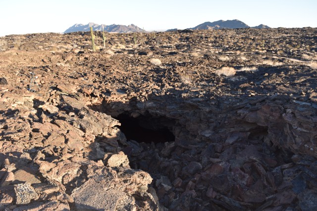
La Burbuja – you can explore a replica at the visitor’s center.
The otherworldly landscape at El Pinacate composed of a volcanic shield with its black and red lava flows, giant craters, cinder cones, and an extensive sea of sand dunes is beautiful and even magical. The difficult terrain means that exploring the area takes time, a high clearance vehicle, and proper equipment are necessary; although, passenger vehicles can travel on the well maintained 72 kilometer (approximately 45 miles) visitor’s route. The visitor’s route is a loop where one can stop at several interpretive stations along the way to learn about different aspects of the Reserve and enjoy the extraordinary views from the edge of El Elegante and Cerro Colorado craters.
Crater El EleganteEl Pinacate Biosphere ReserveEl Pinacate Biosphere Reserve
El Pinacate’s location is within the boundaries of the Lower Colorado Subdivision of the Sonoran Desert, which is the hottest and driest subdivision, yet despite the harsh conditions El Pinacate’s biodiversity is impressive. The recorded number of species includes more than 540 vascular plants, 44 mammals, 40 reptiles, 5 amphibians, more than 200 birds, and 2 native fish species.
Sonoyta pupfish (adult males) picture taken at refuge pond.
El Pinacate is home to endangered species such as the Sonoran pronghorn, Sonoyta pupfish, longfin dace, and the largest maternity colony of lesser long-nosed bats which were classified as endangered in Mexico until recently and whose current endangered status in the United States is being reviewed. A lava tube in the volcanic shield houses the maternity colony. The place is not open to the public, but I have been lucky to have had the opportunity to accompany American and Mexican biologists on nights set aside for bat exit counts. Witnessing thousands and thousands of bats exiting the cave on their way to foraging grounds is an amazing experience that alerts all the senses.
Lesser long-nosed bat maternity colony entrance at El Pinacate Biosphere Reserve.
Other species of common concern between the U.S. and Mexico but with differing threatened or endangered status include the flat-tailed horned lizard and the Sonoran desert tortoise. During my most recent trip to El Pinacate, my companions and I came across a pair of desert bighorn sheep as we were hiking in the evening towards a tinaja to conduct a bat monitoring survey. Lesser long-nosed bats aren’t the only bat species present at El Pinacate and we were fortunate enough to see some of the other species.
Flat-tailed horned lizard
Sidewinder
California leaf-nosed bat
Townsend’s big-eared bat
Townsend’s big-eared bat
Pallid bat
El Pinacate is named after the common stink beetle or pinacate found throughout the region; I can only imagine the diversity of insects that call El Pinacate home. El Pinacate is a fascinating place that beckons further exploration. I hope to go back in the winter so that I can hike to the top of the highest mountain to get a bird’s eye view of the majestic landscape.
Sources where you can obtain more detailed information:
Reserva de la Biosfera El Pinacate y Gran Desierto de Altar
Organ Pipe Cactus National Monument is located in southwestern Arizona in the heart of the Sonoran Desert. The national monument is bisected by the southernmost portion of State Route 85 which ends at the U.S.-Mexico border; in fact, the 31-mile southern boundary of the national monument is the border. The Kris Eggle Visitor Center is located approximately 25 miles south of Why, Arizona and approximately 36 miles south of Ajo, Arizona on Highway 85.
There are many reasons to visit Organ Pipe Cactus National Monument some of which include the opportunity to see an organ pipe cactus since the monument was established in 1937 to protect the species’ northernmost habitat in the United States. Organ pipe cacti are more common in southern regions across the border where they are less prone to frost. The national monument protects 516 square miles of Sonoran Desert habitat – over 95% is designated as wilderness.
Organ Pipe Cactus
Organ Pipe Cactus National Monument
Ironwood Blossoms
A wilderness designation refers to the highest level of protection federal lands are eligible for, and only Congress can designate wilderness areas within existing public lands. Organ Pipe Cactus National Monument is administered by the National Park Service. The National Park Service is celebrating its Centennial in 2016, so go ‘Find Your Park’ (#FINDYOURPARK) for more information about Centennial celebrations. Organ Pipe Cactus National Monument is also a Biosphere Reserve. Biosphere Reserves are non-regulatory protected areas that differ from other national designations and are part of a world network of biosphere reserves under the umbrella of UNESCO’s Man and the Biosphere Program.
Organ Pipe Cactus National Monument is home to endangered species such as the Sonoran pronghorn and the Quitobaquito pupfish year round and seasonally to the Lesser long-nosed bat which migrates to the Sonoran desert in the spring from central Mexico to give birth to their young and to feed on the nectar and fruit of the organ pipe cactus and saguaros. Visitors can enjoy the abundant wildlife, the unpolluted night sky, drive on scenic roads, hike desert trails, camp, or just stop by the visitor’s center for an introduction to the monument.
The Ajo Mountain scenic loop is 21 miles.
Of course as with most things in life, the monument’s existence has not been a fairytale, being on the US-Mexico border has led to unique circumstances that affect the entire border region not just the monument. The US-Mexico border region is an area where the supply and demand of illegal drugs and cheap labor is the most evident, and ever since an intense crack-down on smuggling at border cities and towns occurred in the 1990’s a lot of the illegal activities shifted to unpopulated, rugged country such as the national monument.
US-Mexico Border at Organ Pipe Cactus National Monument
That bus was transiting on Mexico’s Highway 2.
US-Mexico border road at Organ Pipe Cactus National Monument
In 2002, Kris Eggle, a law enforcement park ranger was killed on duty by a drug trafficker. After the park ranger’s death, a vehicle barrier was constructed along the border and most of the land was closed to the public until 2014 when public access to the entire national monument was reinstated.
One of the areas previously off-limits to the public was Quitobaquito Pond due to its proximity to the border – only a few meters from the fence. Quitobaquito is a special place not only for its ecological significance but because of its cultural significance as well. Artifacts dating back 16,000 years have been found in the area. Quitobaquito is associated with a prehistoric trade route known as the Old Salt Trail in which the ancient inhabitants of the land traded salt, obsidian, and seashells. Quitobaquito Springs later became the home of the Hia C-ed O’odham and the Tohono O’odham. Currently, the eastern boundary of Organ Pipe Cactus National Monument coincides with the southwestern boundary of the Tohono O’odham Nation.
QuitobaquitoQuitobaquito pond is fed by natural springs.
The ecological significance of Quitobaquito cannot be overstated. Quitobaquito is the only natural place where the endangered Quitobaquito pupfish (Cyprinodon eremus) can be found in the U.S., and it is the only place in the U.S. where the Sonoyta mud turtle and the tiny Quitobaquito springsnail can be found. Quitobaquito pupfish can also be found in a handful of artificial refuge ponds in Arizona and Sonora.
Quitobaquito/Rio Sonoyta Pupfish ~ picture taken at refuge pond in Mexico.
I had visited Organ Pipe Cactus National Monument before, but it wasn’t until my most recent visit in the spring that I got to see Quitobaquito and many other areas that I probably would not have visited had it not been for the fortunate opportunity I had to help out on a wildlife camera deployment project led by the Sonoran Desert Monitoring Network. Deploying wildlife cameras means hiking off-trail to remote areas that are not generally frequented by the general public, so there is a sense of being out in the ‘wilderness’; a conflicted wilderness, but a wilderness nonetheless.
The Border Patrol’s presence has increased over the years and more agents with more vehicles led to a lot of illegal roads within the wilderness area, before the installation of the vehicle barrier, drug traffickers also created illegal roads. Off-road driving inevitably leads to habitat fragmentation; fortunately, the Department of Homeland Security funded a road restoration project recently at Organ Pipe Cactus National Monument and at adjacent Cabeza Prieta National Wildlife Refuge; thus far, miles and miles of roads have been restored.
Restoration area near border fence.
From a bird’s eye view the landscape looks unspoiled, but in certain ‘high traffic’ areas you do encounter trash left behind by border crossers and ATV tracks left behind by law enforcement. A common item that litters the landscape and can be found anywhere along the border not just at the national monument is the iconic black water jug – a plastic item – that represents the difference between life and death in a hostile environment. I want to clarify that even though we hiked many miles the area we covered represents only a tiny fraction of the land and we also encountered many places where the landscape appeared pristine.
The most haunting find during my recent visit was a bunch of brand new white socks…pairs of white socks left behind miles and miles away from the nearest road instead of covering someone’s blistered feet…someone traversing very difficult terrain.
Non-profit organizations such as Human Borders services and maintains emergency water stations throughout the Sonoran desert border region in an effort to prevent migrant deaths – according to some reports since 2001 over 2,000 people have died attempting to cross the Arizona-Mexico border as a result of dehydration, sunstroke, and exposure. The Border Patrol also rescues people throughout the region. Emergency assistance towers next to roads where people can pick up the phone and request assistance can be seen from a great distance.
The blue flag waving in the distance signals the availability of water provided by Humane Borders.
A few days are not enough to explore the many corners of the monument, and there are still many corners I want to explore especially in the mountains. I encourage people to visit Organ Pipe Cactus National Monument and other natural protected areas along the border so they can see for themselves what it is like and to learn about the many wildlife and cultural treasures along the border, but remember if you go, always go prepared with more water than you think you need and always be cautious of your surroundings. Organ Pipe Cactus National Monument is a truly special place, so if you’re ever in the area don’t hesitate to visit – it is worth it.
For more information about Organ Pipe Cactus National Monument go to:
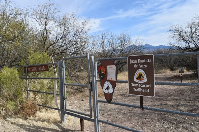
The 1200 mile long Juan Bautista de Anza National Historic Trail commemorates the 1775-76 expedition led by Juan Bautista de Anza to establish a mission and presidio or garrison – in what is now San Francisco, California – during Spanish colonial rule. Juan Bautista de Anza led more than 240 men, women, and children along with their belongings, horses, pack animals, and heads of cattle from San Miguel de Horcasitas Presidio in what is now the state of Sonora, Mexico to what is now the San Francisco Bay Area. The journey took six months to complete. The Juan Bautista de Anza National Historic Trail is managed by the National Park Service and in the U.S. the trail starts in modern day Nogales, Arizona and ends in modern day San Francisco, California. Recently, I followed a small section of the historic trail that parallels and crosses the Santa Cruz River in Arizona from Tumacacori to Tubac.
Juan Bautista de Anza was born in Fronteras Presidio, Sonora in 1735 or 1736; de Anza became Captain of the Presidio of Tubac in 1774; and, that same year he travelled from Tubac to Mission San Gabriel and Monterrey Presidio in California to establish a direct land route to Alta California. Juan made a second journey to Alta California following the same route in 1775-76. The main reason why Spanish authorities wanted to establish a new settlement in San Francisco was to halt the advancement of Russian settlements in Alta California – the southernmost Russian settlement was Fort Ross.
After he returned from his second journey to Alta California, Juan de Anza was named Governor of New Mexico. He died in 1788 in the town of Arizpe in what is now the Mexican state of Sonora. Even though the trail is named after Juan Bautista de Anza, there is no doubt in my mind that his success in finding a safe land route could not have been possible without the help of Native Americans as guides, interpreters, and their keen knowledge of the land and its resources.
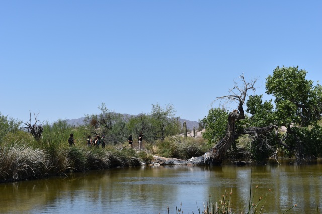
The Anza Trail was designated as a National Historic Trail in 1990. It traverses five counties in Arizona and 14 counties in California. I only walked 3.5 miles of the trail in Santa Cruz County; nonetheless, I think this small section is a great place to get an idea of what the expedition members encountered on the road. The Santa Cruz River offered the expedition a reliable source of water and relatively easy terrain on which to travel.
Santa Cruz River
Anza Trail
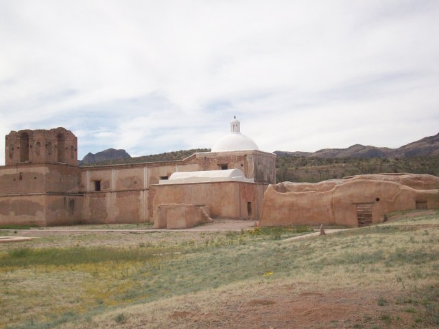
The Santa Cruz River is the only river in the United States that crosses an international border twice; it originates in the Canelo Hills of southeastern Arizona then flows south to Mexico, makes a U-turn after a few miles, and returns to Arizona near Nogales. Currently, the Santa Cruz River is dry most of the year except during the monsoon season when it is common to see surface water on the river bed. The section of the river between Tumacacori and Tubac is effluent dependent. The treated wastewater comes from the Nogales International Wastewater Treatment Plant – I mention more details about the wastewater treatment plant and Tumacacori Mission in a previous blog post published in April of 2014.
Tumacacori National Historical Park
Despite the source of the surface water I find this section of the Anza Trail appealing since the cottonwood-willow gallery and the mesquite bosque provide a serene environment in which to contemplate the history of the region and enjoy the wildlife that depends on the riparian area. Riparian areas are extremely important for local and migrating wildlife species such as birds; riparian areas are also threatened ecosystems. In Arizona, it is estimated that less than 10% of the state’s original riparian habitat remains intact. According to the Arizona Riparian Council, approximately 60-75% of the state’s resident wildlife species depend on riparian areas to sustain their populations; yet, riparian areas occupy less than 0.5% of Arizona’s total land area.
Santa Cruz River
Important Bird Area Ramada
The Santa Cruz River riparian area is recognized as an Important Bird and Biodiversity Area. A testament to the importance of this area for the biological diversity of the region is the recent rediscovery of the Gila topminnow. The Gila topminnow is 1-2 inch Endangered native fish. This native fish was last seen in the Upper Santa Cruz River in 2005, and after a 10 year absence the native fish species was reported during the most recent fish survey in 2015. The re-appearance of Gila topminnow in the river is possibly due to incoming flash floods from Sonoita Creek – a tributary of the Santa Cruz River where the endangered fish can still be found.
I personally did not see any fish this last time I hiked the trail, but I do remember seeing fish in the early 2000’s. The Anza trail between Tumacacori and Tubac crosses the river a couple of times, the crossing is made easier by pedestrian foot bridges provided by the Arizona Anza Trail Coalition. I hiked the trail in mid-January and possibly due to recent winter rains or maybe as a result of the last monsoon season – a portion of the trail before Clark Crossing – and possibly part of the trail located on private land all but disappeared. On that particular section of the river, a good amount of wooden debris had accumulated as well as a good amount of trash. After what felt like a leisurely walk by the river and across foot bridges the time had come to get wet and muddy feet – I enjoyed it since it provided me with an opportunity to wonder what the Anza expedition had encountered along this stretch of the river. The section of the trail from Clark Crossing to Tubac is well maintained and it’s an easy walk.
Tubac was Camp #14 of Anza’s expedition and it’s where Anza gathered all of the future settlers, made final preparations, and set out in October of 1775 as a complete expedition. Tubac had been settled by Pima Native Americans for centuries prior to the arrival of Spanish colonists. The Presidio of Tubac was founded in 1752 in response to an uprising of the local Pimas. The old presidio walls are mostly gone but portions of it as well as the presidio’s foundation can still be seen at Tubac Presidio State Historic Park – which happens to be Arizona’s 1st state park.
Restored adobe home at Tubac State Historic Park
Tubac had Arizona’s 1st printing press and Arizona’s 1st newspaper.
Spanish influence was felt 200 years before their arrival in the region in the form of the devastating effects on the native population of diseases and epidemics introduced by Spanish colonists.
Grindstones
School building – Tubac State Historic Park
School corporal punishments in the 1800’s…check out #12 lol!
Classroom in old school building – Tubac State Historic Park
The town of Tubac has experienced many changes and rebirths throughout the centuries most recently as a hub for artisans and tourists in Southern Arizona; yet old Tubac where Tubac Presidio State Historic Park is located retains its small southwestern town charm. A visit to the State Historic Park and its surroundings is a visual treat since one can get a sense of the different cultural influences in the region ranging from Native American, Spanish, Mexican, and finally Anglo-European.
St. Anne’s Catholic Church in Old Tubac
Old Tubac
Old Tubac
Tumacacori National Historical Park, the Anza Trail, the Santa Cruz River, and Tubac Presidio State Park are all easily accessible via Interstate 19 which connects Nogales, Arizona on the border with Mexico to Tucson, Arizona only about 60 miles away making it one of the shortest Interstates in the U.S and also a unique one since distances are given in meters and kilometers unlike other Interstates, so the next time you travel on I-19 or if you are ever in this area remember to look East and think about all the history and biodiversity present along this corridor.
Las Cienegas National Conservation Area is located 45 miles southeast of Tucson, Arizona; about 40 miles north of the US-Mexico border; and, about 10 miles north of Sonoita, Arizona on Arizona Highway 83. Las Cienegas National Conservation Area consists of 45,000 acres of public land managed by the Department of Interior’s Bureau of Land Management (BLM). The vegetative communities at Las Cienegas are typical of what was common centuries ago and is now rare such as cottonwood-willow galleries, semi-desert grassland, sacaton grasslands, cienegas, and mesquite bosques. Las Cienegas is also an example of the gradual transformation of the land over the course of the last 150 years or so from native grasslands into mesquite woodlands as a result of changes in the natural fire regime and cattle grazing.
One of the most visible negative consequences of land degradation is loss of habitat for grassland depended species such as pronghorn and prairie dogs just to name a few, but there are other equally important yet inconspicuous consequences such as watershed functions. The BLM is currently implementing a grassland restoration project on 20,000 acres of degraded habitat at Las Cienegas, whereby mechanical thinning of mesquite woodlands, they hope to reestablish a healthy grassland ecosystem for the benefit of wildlife and all who wish to enjoy it.
Las Cienegas National Conservation Area
Las Cienegas is not only home to 60 species of mammals, 230 species of birds, 43 species of reptiles and amphibians, and 3 species of native fish including some that are listed as threatened and endangered such as the Gila topminnow and Southwestern willow flycatcher, but is also home to Empire Ranch. Empire Ranch was founded in 1876 with the purchase of a 160-acre ranch originally established in the 1860’s as a homestead ranch. Over the years the ranch house as well as the ranch itself expanded and changed ownership a few times until 1988 when the BLM acquired the lands through a public-private land swap and created the Empire-Cienega Resource Conservation Area. In 2000, the U.S. Congress established the 45,000 acre Las Cienegas National Conservation Area.
Empire Ranch House
The lands occupied by Empire Ranch and Las Cienegas have a rich and complex ownership history from the original inhabitants and owners – Native Americans – to the beginnings of Spanish physical presence in 1691 to Mexican ownership as a result of Spanish independence in 1821 to the sale of the lands encompassing modern day southern Arizona and southwestern New Mexico in 1854 in what is known as the Gadsden Purchase.
In 1997, the non-profit Empire Ranch Foundation was founded with the aim of protecting and restoring Empire Ranch’s historical buildings. The ranch house – a 22-room building which dates to 1870 – was listed on the National Register of Historic Places in 1975. Thanks to the Empire Ranch Foundation and its supporters the Empire Ranch House has been preserved and can be enjoyed free of charge on self-guided tours year-long. Each room retains its charm and one can get a sense of what life was like in the rural southwest by experiencing the atmosphere recreated in each room and/or reading about it on the interpretative signage throughout the building.
Old meat cooler at Empire Ranch House
Empire Ranch House
Near the ranch house one can also enjoy a short but pleasant half-mile walk on the Heritage Discovery Trail which meanders next to a cottonwood grove. There are many outdoor activities that people can enjoy at Las Cienegas, but a unique watchable wildlife opportunity in Arizona is only available at Las Cienegas – watching black-tailed prairie dogs. Remember to always be respectful of all wildlife – for wildlife watching tips visit Arizona Watchable Wildlife Tourism Association at http://www.azwatchablewildlife.org/index.php/wildlife-resources/viewing-tips.
Black-tailed prairie dog
Black-tailed prairie dog colony at Las Cienegas National Conservation Area
Prairie dog town!
Black-tailed prairie dogs are one of five species of prairie dogs and the species with formerly the most expansive range – from southern Canada to northern Mexico. Unfortunately, over the past 150 years their range has been reduced to less than 2% and accordingly their numbers have been greatly reduced. In Arizona, black-tailed prairie dogs were exterminated in 1960. Fortunately, wildlife agencies and multiple partners have worked together to re-establish the species not just in Arizona but across their historic range. In Arizona, black-tailed prairie dogs were first re-introduced in 2008 and since then three colonies have been successfully established at Las Cienegas. Prairie dogs are a grassland dependent keystone species; that is they have a big impact on their ecosystem, and other species depend on them for food and shelter. The reintroduction of black-tailed prairie dogs at Las Cienegas National Conservation Area is a positive sign on the road to restoring a diverse and healthy ecosystem.
If you’d like to learn more visit the following websites:
Las Cienegas National Conservation Area – BLM Website
The Reserva de la Biósfera Alto Golfo de California y Delta del Río Colorado (Upper Gulf of California and Colorado River Delta Biosphere Reserve) is located in the northwestern Mexican states of Sonora and Baja California about 60 kilometers from the U.S.- Mexico border. The approximate 9,400 km² protected by the reserve include amazing marine and desert ecosystems.
Reserva de la Biosfera Alto Golfo de California y Delta del Rio Colorado
The Alto Golfo Biosphere Reserve has received international recognition and numerous accolades since its inception in 1993. The Reserve is part of UNESCO’s Man and the Biosphere Program. Its wetlands have been recognized by the Ramsar Convention as internationally important; hence, it counts with three Ramsar sites. Additionally, the Alto Golfo Biosphere Reserve is part of the Western Hemisphere Shorebird Network; a voluntary network that seeks to conserve shorebirds and their key habitats throughout the hemisphere.
I had the opportunity of visiting part of the Alto Golfo and Colorado River Delta Biosphere Reserve – on the Sonora side – a few weeks ago and was amazed by the biodiversity, the striking landscapes as well as enlightened about the complexity of the issues faced by communities and reserve managers on a daily basis. I was also saddened by the prospects of some species such as the critically endangered Vaquita or harbor porpoise, yet encouraged to see actions being taken and implemented to help conserve endangered species while also taking into consideration people’s livelihoods.
My first stop included a visit to La Ciénega de Santa Clara. The Ciénega de Santa Clara is a remnant of the vast network of wetlands that once existed in the Colorado River Delta; a network that almost ceased to exist as waters from the Colorado River were claimed by different sectors and an ever expanding population. The Ciénega de Santa Clara was created by accident in 1976 by the Army Corps of Engineers in Arizona, and it is still maintained by drainage from agricultural districts in southwestern Arizona. The Ciénega is now considered an extremely important site for birds traveling on the Pacific Flyway. It is also home to the endangered Yuma clapper rail, the Desert pupfish, as well as numerous non-native fish species. The Ciénega de Santa Clara consists of approximately 40,000 acres of marshlands, cattail stands, a maze of lagoons, and extensive mudflats.
Cienega de Santa Clara
While visiting the Ciénega I learned about some of the income diversification projects undertaken by the communities living in lands adjacent to the Ciénega, and I was pleasantly surprised to see ecotourism ventures providing alternatives to the people of the Ciénega. I took a boat ride into the lagoons from a dock operated by community members. I also saw a row of cabins that are rented out by the local community where people can stay and explore the Ciénega at a more leisurely pace. I have to say that it was truly amazing to suddenly see an extensive body of water after driving on a road that bisects mudflats that extend as far as the eye can see.
Cienega de Santa Clara dockOne of the many bird species that visit the Cienega de Santa Clara
After observing, hearing, and learning about the many species of birds that can be found at the Ciénega, the visit proceeded with stops at other spring fed wetlands and/or smaller ponds where one can find the endangered Desert pupfish – a small resilient freshwater fish species only found in the driest part of the Sonoran desert in California, Arizona, Baja California, and Sonora. It was encouraging to see other small communities have undertaken various ecotourism projects that are at different stages of development and/or completion but that highlight the many opportunities available for visitors and locals alike.
Desert pupfish habitatEcotourism projects
The visit then continued on to a short visit to the fishing town of El Golfo de Santa Clara – home to about 4,000 people – according to the 2010 population census. I recently learned that the town of El Golfo de Santa Clara was established in the early part of the 20th century to take advantage of the once plentiful totoaba (Totoaba macdonaldi) fishery, as was the case for the town of San Felipe in Baja California. Totoaba annual captures were once measured in thousands of tons, but since 1975 the Mexican government declared a total ban.
Golfo de Santa Clara
The causes of the decline in the Totoaba population are many and quite complex and are still present to this day. Totoabas spawn in the Colorado River Delta and since the construction of dams in the U.S. i.e. Hoover dam, the Colorado River ceased to reach the delta. The decrease in freshwater led to an increase in salinity which changed the ecosystem and led to loss of spawning habitat. Additionally, totoabas were overfished due to a high demand for their swim bladder in Asia. Apparently, it is regarded as a delicacy in China and it’s also used in traditional Chinese medicine among other things to increase fertility i.e. as an aphrodisiac which by the way seems to be attributable to all sorts of animal parts which just boggles my mind….to which I say just buy some Viagra if you so desperately need a lift in that department…anyway I digress. Totoaba fish bladders are still highly sought after and apparently they can be sold for up to $5,000 per bladder in the black market.
Golfo de Santa Clara
Totoabas were easy to capture on their way to and/or from their spawning grounds and the use of gillnets greatly affected another species that is also critically endangered, the Vaquita (Phocoena sinus). Vaquitas or harbor porpoises were by-catch in the totoaba fishery. Vaquitas were caught in gillnets and drowned. Vaquitas are also endemic to the Upper Gulf of California meaning that they are only found in that region. They have the most limited range of any marine mammal. The prospects for the Vaquita are dire; their total population is estimated to be less than 100 and some report only 57 individuals are left.
In the spring of 2015, drastic measures were put in motion when the Mexican federal government put in place a two-year total ban of gill net use in the Vaquita’s territory and expanded the overall protection zone. The federal government also put in place a two-year compensation program for fishing communities where all those involved in fishing activities are being compensated for not fishing. The results of the two-year experiment remain to be seen; hopefully, the results will be positive for the vaquita, the totoaba, and the overall health of the ecosystem. Yet, there remains to be seen what will happen once the two-year compensation program ends…will residents of the Upper Gulf of California transition into other income generating activities? Or will they go back to fishing using gill nets?
The issues are extremely complex and there are no easy solutions; yet, I am hopeful different sectors of the population will find ways of working together to find common ground that will lead to a better quality of life for fishing communities and a healthy populations of vaquitas, totoabas, and all marine life…that – or maybe the Chinese economy will crash and people will no longer be able to afford exotic ingredients for their soups and/or medicine i.e. totoaba swim bladders, shark fins, bear gallbladders, etc. I know that’s not likely to occur in the near future and a crash of the Chinese economy would negatively affect the rest of the world, so what is needed is more education targeted to consumers in Asia that may not be aware of the far-reaching consequences of their actions when they order a bowl of totoaba fish bladder soup.
Anyway, I haven’t written any blog posts in a year…and I told myself I would aim to make future blog entries shorter…I failed, so if you’ve read up to this point – a big thank you. I mainly focused on the coastal and marine aspects of the Biosphere Reserve, but there is so much more to see and explore. I didn’t even expand on the wonders of the desert areas such as the massive sand dunes and the wildlife that inhabits it such as flat-tailed horned lizards or the fact that the Colorado River reached the delta in 2014 for the first time in decades thanks to the work being done by a committed group of organizations that were able to purchase water rights. For eight weeks in the spring of 2014 water from a dam was released and allowed to follow its natural course…there’s just so much to see and learn and write about that I will probably revisit the Alto Golfo de California y Delta de Rio Colorado Biosphere Reserve in the future, and I highly encourage you to do the same if you are in the region.
Cienega de Santa Clara
To learn more about El Alto Golfo de California y Delta de Rio Colorado Biosphere Reserve and its wildlife check out the following websites:
Janos Biosphere Reserve is a protected area located in northwestern Chihuahua, Mexico. The northernmost portion of the reserve is adjacent to the border with New Mexico. The reserve was established in 2009 and covers 526,482 hectares of predominantly shortgrass prairie and temperate forests. The reserve is located in the Janos valley within the Chihuahuan desert, and it’s the first of its kind in Mexico to focus on the protection of grasslands. Grasslands are one of the most endangered ecosystems worldwide since most have been converted to agricultural lands and what remains continues to be modified or affected by human development. North American prairies once extended from southern Canada all the way to northern Mexico and it is estimated that before European settlement between 30-60 million bison roamed the prairies along with pronghorn and other iconic species such as wolves and grizzlies.
Wherever prairie ecosystems remain in good condition they boast incredible biodiversity and such is the case in Janos where the second largest black-tailed prairie dog complex in North America can be found, as well as the largest population of golden eagles in Mexico, and the only wild bison population in Mexico. More than 250 species of plants have been recorded as well as more than 380 species of animals. Some of the species that can be found include burrowing owls in prairie dog colonies, thick-billed parrots in the forested mountains, and a great diversity of snakes and lizards throughout the reserve. Grizzlies, wolves, bison, and most pronghorn gradually disappeared with the arrival of European settlement and the conversion of the land into agricultural fields and cattle ranches. In 2009, a small herd of bison was reintroduced at the Nature Conservancy’s Rancho El Uno, and it was the first time in over a century that wild bison roamed Mexican prairies.
Another iconic species of the North American prairies whose current overall population is less than 2% of what it was over two centuries ago is the prairie dog. There are five species of prairie dogs in North America. Black-tailed prairie dogs occupy the most extensive range. Prairie dogs are social diurnal burrowing rodents that live in colonies that can extend for miles and can house thousands of individuals. Prairie dogs are considered a keystone species – they play a critical role in the structure and function of their ecosystem disproportionate to their abundance – thus, the collapse of prairie dog colonies leads to dramatic changes in overall species composition. A notable example of this is the near extinction in the wild of black footed ferrets which are completely dependent on prairie dogs for food and shelter. By the mid-1980’s only 18 black-footed ferrets remained in the wild in all of North America. Fortunately, tremendous effort has been carried out by different agencies and organizations and the species was brought back from the brink of extinction; although, their long-term survival is dependent on the protection and the long-term survival of prairie dogs. Black footed ferrets have been reintroduced in a handful of places including Janos Biosphere Reserve.
Many farmers and ranchers have been at war with prairie dogs for decades and millions have been poisoned throughout the North American prairies since they are perceived as foraging competitors, their burrows are perceived as potential hazards for cattle, and are considered voracious consumers of commercial crops. A more recent threat; yet, equally devastating to prairie dogs is the arrival of plague which is transmitted by fleas and completely wipes out entire colonies. The maligned image of prairies dogs by certain groups is unfounded since before the arrival of cattle, bison coexisted with prairie dogs for centuries, and it has been demonstrated that bison and pronghorn prefer to forage in prairie dog colonies due to a higher occurrence of highly nutritious plants.
Prairie dogs are a critical component to the health and biodiversity of prairie habitat since their digging aerates the soil; they prevent shrub encroachment; their burrows provide shelter and nesting habitat for species such as burrowing owls; and, prairie dogs are prey for many species not just black footed ferrets. Prairie dogs are not the only keystone species found in the reserve, kangaroo rats are also considered ecosystem engineers; although, their activities and burrows change the landscape in a different direction since the storage and germination of seeds inside the burrows leads to shrub growth.
Kangaroo rat burrowPrairie dog burrowPrairie dog burrow used by burrowing owls
The region where the reserve is located is not densely populated and consists of small communities of traditional ranchers, farmers, and Menonite communities. The human population within the municipality of Janos where the reserve is located was estimated to be just under 11,000 in 2010; nonetheless, the long term effect of human activities such as intensive agriculture is still a concern for the long term sustainability of the ecosystem and the regional economy. Some of the threats that could affect the reserve include groundwater depletion to support intensive agricultural practices, overgrazing, soil erosion, and desertification. Janos Biosphere Reserve is a relatively new protected area and as such there is still a lot of work that needs to be done – which seems to be underway – to find balance between conservation and wise management of natural resources so that human economic activities can continue to flourish for a long time alongside a healthy ecosystem.
ALL PHOTOS COURTESY OF ARIZONA GAME AND FISH DEPARTMENT (AZGFD)
The Chiracahua Mountains in southeastern Arizona are part of the Coronado National Forest. The sky islands (also known as the Madrean Archipelago) of southeastern Arizona, southwestern New Mexico, and northwestern Mexico are isolated forested mountain ranges surrounded by seas of desert grassland or desert. This region is one of 35 global biodiversity hotspots. Biodiversity hotspots are regions that house a high degree of endemic species and are highly threatened by a myriad of reasons such as habitat destruction and fragmentation. The Chiracahuas – as well as most forested lands in the country – are threatened by catastrophic wildfires. It is important to note that fire is a natural process that benefits the land, but catastrophic wildfires are a different story since the intensity and duration of such fires completely burns forests and destroys wildlife habitat. The most recent catastrophic wildfire in this particular region occurred in 2011.
The diversity of wildlife species in the Chiracahuas is truly amazing, bird species at their northernmost range can be found in these mountains. A great diversity of mammals can be found including the winged variety as well as many species of slithering reptiles. One of the many species that call the Chiracahua mountains home is the Chiracahua leopard frog (Lithobates chiricahuensis). The historical range of the species extends to central and SE Arizona, west central and SW New Mexico in the U.S. and NE Sonora and NW Chihuahua in Mexico. The current range is similar but the difference is that remaining populations are typically small and isolated. The population of Chiracahua leopard frogs started declining decades ago, and in 2002 the U.S. Fish and Wildlife Service listed it as a threatened species under the Endangered Species Act. Reasons for the decline include increased predation by non-native species such as bullfrogs and crayfish, chytridiomycosis or Bd which is a fungal disease that has greatly affected amphibians all over the world, and habitat loss and/or degradation as a result of water diversion and catastrophic fires. A recovery plan was finalized in 2007 and is currently being implemented with the aim of reestablishing populations and delisting the species.
Chiracahua Leopard Frog Photo Courtesy of AZGFD
Typical Chiracahua leopard frog habitat includes permanent or semi-permanent water sources at 1,000-2,700 meters in elevation (3,281-8,890 feet) such as streams, springs, ponds, and even livestock tanks. Small isolated populations cannot persist for long, so suitable habitat needs to be enhanced, restored, or created to help the frogs find dispersal routes and to re-establish metapopulations. In early May, a group of people from different organizations participated in a wetland restoration and creation workshop led by Thomas R. Biebighauser – a leader in the wetland restoration/creation field – to benefit Chiracahua leopard frogs as well as other species such as bats. The workshop was hosted by the American Museum of Natural History’s Southwestern Research Station in Portal, Arizona; coordinated by Sky Island Alliance; and attended by representatives from Arizona Game and Fish Department, U.S. Forest Service, U.S. Fish and Wildlife Service, and other organizations as well as volunteers.
In addition to classroom instruction, participants got hands-on learning experience by aiding in the creation of four ponds: one on private land and three on national forest land. Depending on the available water sources and the clay content in the soil, different techniques can be used: the groundwater technique, the liner technique, and the surface water technique. An integral part of any of the techniques is the use of heavy equipment such as an excavator, dozer, or backhoe. In our case due to relatively small size of the ponds and limited access to the sites – a small excavator was enough. Additionally, the appropriate soil tests that informed the final designs of the ponds were conducted prior to the workshop, so the idea was for participants to help in the implementation of the designs.
The liner technique was used at the private land owners’ pond since the soil lacked enough clay content to hold water without one. A nearby groundwater well was to become the permanent water source for the pond. The liner technique consists of removing the topsoil and vegetation and creating a depression with a gradual slope; in our case we wanted the deepest part of the depression to be at least 3 feet deep in order for the Chiracahua leopard frogs to use the ponds as breeding sites. After the excavator dug the depression, we prepared it for the liner by removing roots and sharp rocks. The liner was actually placed between two layers of geo-textile fabric for protection and joined together with spikes. The excess material was trimmed off, and the excavator covered the liner with six inches of soil. Finally, soil was evenly spread and woody debris was placed in and around to enhance the newly created wetland habitat. Water started to flow soon after; and hopefully, in the not too distant future Chiracahua leopard frogs will thrive in the new pond.
All Photos Courtesy of AZGFD
Ash Springs in the Coronado National Forest was the other location where three ponds of different sizes were constructed. An 18% slope was the reason the design called for the creation of more than one pond – that is in order to decrease the likelihood of erosion. The ponds at Ash Springs were constructed in a similar fashion as the previous one, but the difference was that the soil contained enough clay so as not to necessitate a liner. In this case, groundwater dams – sections where soils with high clay content are packed tightly to prevent water from seeping out – were constructed. The water source for these particular ponds was a spring, and the ponds were constructed so as to allow water to slowly cascade from one pond to the next. Finally, exposed soils were covered with native hay and native plants were planted to prevent erosion. It will be sometime before Chiracahua leopard frogs are introduced to these ponds, but hopefully the newly available habitat will contribute to the species recovery.
All Photos Courtesy of AZGFD
My intention for this blog is to highlight the rich biodiversity of the borderland region and encourage people to participate in sustainable travel opportunities – participating in workshops such as this one is a great way to contribute to biodiversity conservation, see some incredible places, contribute to the local economy, and learn a thing or two along the way. Happy sustainable travels!
Courtesy of AZGFD
Sources of information where you can
learn more about frogs, wetlands, sky islands, and other related information:
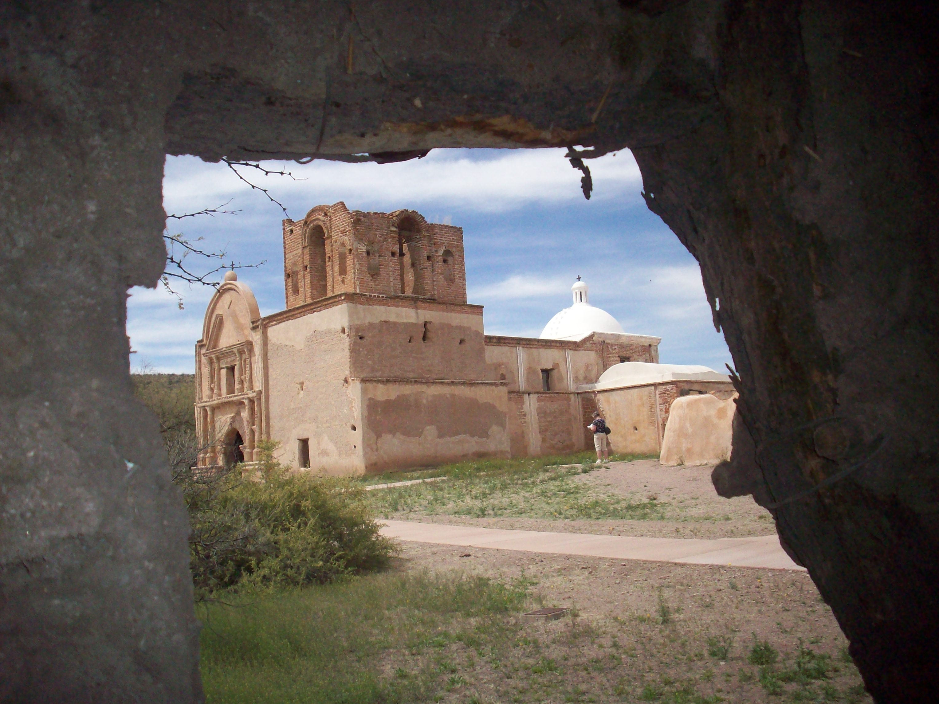
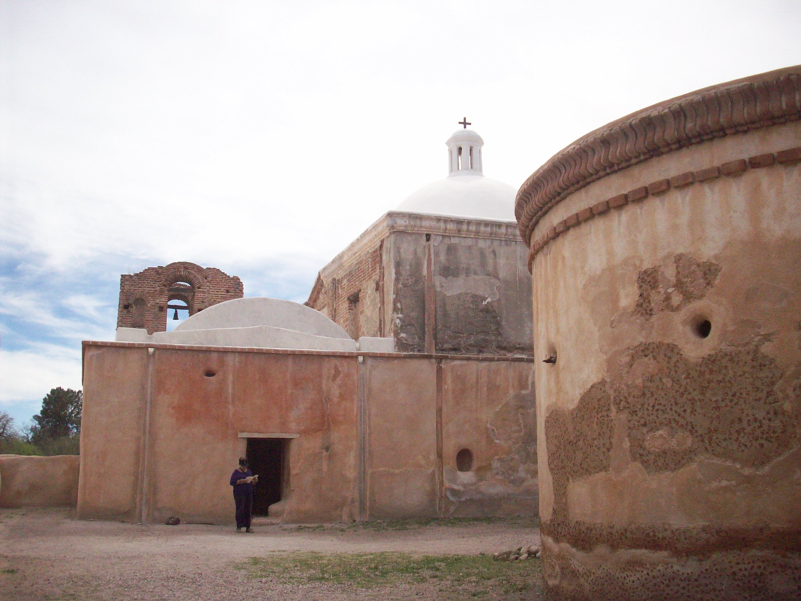
A few years have passed since I last visited Tumacacori National Historical Park and the nearby stretch of the Santa Cruz River. I am glad I recently went back. Tumacacori, Arizona is located 18 miles north of the border town of Nogales on Interstate 19 (Exit 29). The original mission was established on the east bank of the Santa Cruz River in 1691 by Eusebio Francisco Kino, a Jesuit missionary during Spanish colonial rule, but the region and the actual settlement of Tumacacori had already been occupied for centuries by the O’odham people, also known as Pima, as well as other groups before them. Father Kino left an indelible mark in the region, so I will probably mention this historical figure in future posts. Following a revolt by Pimas, Tumacacori was relocated to the west side of the river. The construction of the church seen today began in the late 1700s. By then, Franciscan missionaries had taken over the Jesuit missions in the region. The goal was to replace a smaller church on mission grounds, but the construction was never finalized due to inconsistent funds and lack of administrators during the early years of Mexican independence and later during the Mexican-American War. The last residents left the mission grounds in 1848, and in 1853 Tumacacori became part of the United States as a result of the Gadsden Purchase.
I don’t know why, but I have a weak spot for old churches. Depending on who you talk to, they can be seen as symbols of conquest, repression, power, faith, community; nonetheless, I like the peacefulness within and I like to admire the architecture. My recent visit to Tumacacori mission included a couple of new surprises – new to me, that is – one was a small yet informative museum that tells the story of the area through different perspectives. My favorite part was listening to Pima, Yaqui, and Apache accounts in Spanish, English, and their respective languages. The other pleasant surprise was the reconstruction of the historic orchard via The Kino Heritage Fruit Trees Project which aims to locate and cultivate fruit tree cultivars that can be traced back to the late 17th and early 18th centuries. Fruit trees such as pomegranate, fig, peach, quince, and apricot. This brought back childhood memories of eating pomegranates, quince, and apricots from neighbors’ trees. I sometimes wondered why such fruit trees could be found in this region with certain frequency, I finally made the connection after seeing the orchard at Tumacacori.
Early settlements, missions – some of which blossomed into cities and/or towns – in this arid region were established along rivers. The Santa Cruz River is a binational river that starts in Southern Arizona, flows south to Mexico, and then makes a U-turn and returns to the U.S. The river is perennial only in a few sections, intermittent in many others, and effluent dependent in key sections. Effluent from the Nogales International Wastewater Treatment Plant (NIWTP) in Rio Rico, AZ is discharged into the river and is the reason one can see surface water a few miles downstream from the plant. The NIWTP has the capacity to treat 17.2 million gallons of sewage per day; it treats around 15 million gallons every day of which 80% comes from Mexico. The last time I walked along the river near Tumacacori, the river was flowing quite nicely; although, I do remember a peculiar smell and some trash. I also remember seeing fish. On this recent walk, there was no smell, no trash, little water, no fish – actually, it was mostly dry. The NIWTP was upgraded in 2009 which improved the quality of the effluent which benefits the wildlife dependent on the river, but apparently Mexico is sending less wastewater to the NIWTP nowadays and that coupled with drought conditions has led to the drying up of sections of the river that used to be perennial.
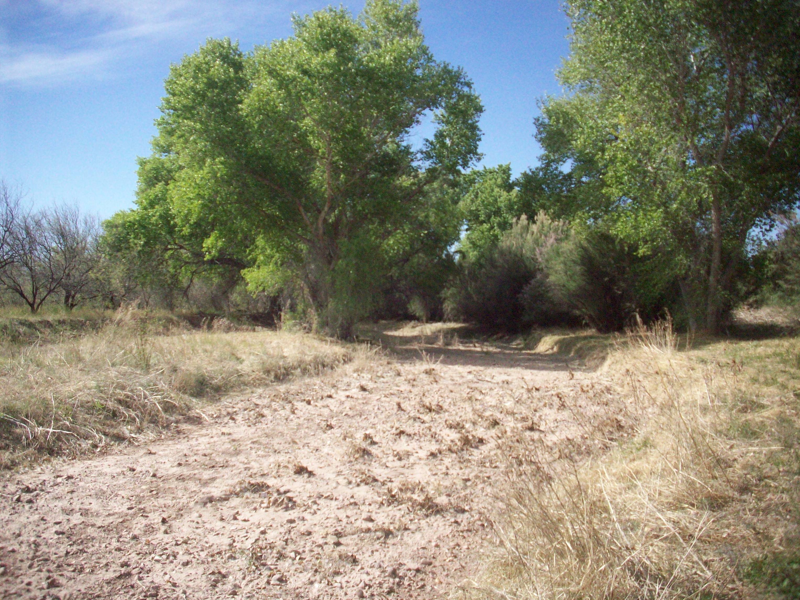
Riparian areas in Arizona are few and far in between, but they are extremely important for resident wildlife as well as migrating birds. I chose this riparian area to start my blog because it has always been my favorite part of the drive between Nogales and Tucson – seeing that green ribbon of cottonwoods surrounded by the yellow-browns of the desert grasslands always brings a smile to my face. The Santa Cruz River riparian area near Tumacacori is primarily composed of cottonwoods, willows, and velvet mesquite bosques or woodlands. The riparian area attracts many species of birds and is an internationally recognized Important Bird Area which attracts many birdwatchers. The Juan Bautista de Anza National Historic Trail runs parallel to the river. The Anza Trail is easily accessible, well-maintained, and clearly marked. I walked a section of the trail between Tumacacori Mission and Clark Crossing Road (approximately 4.5 miles roundtrip). I wasn’t there at the ideal time of the day when birds are most active, but I did see/hear some activity. The Juan Bautista de Anza National Historic Trail is very interesting for its cultural, recreational, and environmental conservation contributions. The historic trail follows the 1,200 mile journey of Juan de Anza and company who in 1775 left this area to establish a settlement in San Francisco Bay. I will revisit a section of the trail near Tubac, Arizona in the near future, and I will share more information about the trail at that time. Thanks for reading my first blog post!
Historia y Naturaleza en Tumacácori y sus alrededores
Han pasado algunos años desde la última vez que visité el Parque Histórico Nacional de Tumacácori y el estrecho del Río Santa Cruz aledaño al lugar; recientemente visité el lugar de nuevo y que bueno que decidí hacerlo. Tumacácori, Arizona está localizado 18 millas al norte de la cuidad fronteriza de Nogales en la carretera Interestatal 19 (Salida 29). La misión original fue establecida al este de la orilla del Río Santa Cruz en 1691por Eusebio Francisco Kino, un misionario Jesuita durante el tiempo de la colonia española, pero la región y la aldea de Tumacácori ya tenía siglos de existencia y de ocupación por pueblos como el O’odham, también conocidos como Pima, así como por otros grupos antes de ellos. El Padre Kino dejó una huella indeleble en la región, así que probablemente volveré a mencionarlo como figura histórica en futuros blogs. Después de una revuelta de los Pimas, Tumacácori fue reubicado al lado oeste del rio. La construcción de la iglesia que vemos hoy en día comenzó a finales de los años 1700s. Para ese entonces, misioneros Franciscanos ya habian tomado el control de las misiones en la región anteriormente administradas por los Jesuitas. La idea era reemplazar un pequeña capilla, pero la construcción de la iglesia nunca concluyó a causa de la inconsistencia de fondos disponibles, así como la falta de administradores durante los primeros años después de la independencia de México y después durante la Guerra Estados Unidos-México. Los últimos residentes se fueron de la misión en 1848, y en 1853 Tumacácori pasó a formar parte de los Estados Unidos como resultado de la Venta de La Mesilla.
No sé porque, pero me encantan las iglesia antigüas. Dependiendo de con quien hables, las iglesias pueden ser vistas como simbolos de conquista, represión, poder, fé, comunidad; sin embargo, me gusta el aire de tranquilidad que se respira dentro de ellas y me gusta admirar su arquitectura. Durante mi más reciente visita a Tumacácori me encontré con algunas novedades – bueno, novedades para mi – una de ellas fue encontrarme con un pequeño museo bastante informativo que relata la histora de la región através de diferentes perspectivas. Mi parte favorita fue escuchar relatos en español, inglés, y lenguas nativas Pimas, Yaquis, y Apaches. La otra novedad con la que me encontre fue la reconstrucción del huerto histórico de árboles frutales através del proyecto ‘Kino Heritage Fruit Project’ que busca localizar y cultivar variedades de árboles frutales cuyo origen se puede rastrear a finales del siglo XVII y principios del siglo XVIII. Árboles frutales de granada, higo, membrillo, y albericoque entre otros. Esto me trajo memorias de mi niñez cuando comía granadas, membrillos, y chabacanos de los árboles de los vecinos. A veces me preguntaba porque se podian encontrar este tipo de árboles frutales en la región con regularidad, finalmente comprendí al ver la huerta en Tumacácori.
Los asentamientos y las misiones – algunas de los/as cuales se conviertieron en cuidades y pueblos – en esta región árida se asentarón a las margenes de los rios. El Río Santa Cruz es un río bi-nacional que nace en el sur de Arizona, fluye hacia México, y después hace una vuelta en U y retorna a Estados Unidos. El río fluye continuamente en pocos tramos, es intermitente en varios, y depende de efluente en algunos tramos clave. Las agua residuales tratadas por la ‘Planta Internacional de Tratamiento de Aguas Residuales de Nogales’ (NIWTP por sus siglas en inglés) en Rio Rico, Arizona descargan al río, y es por eso que se puede ver agua en la superficie algunas millas río abajo de la planta. NIWTP tiene capacidad para tratar 17.2 millones de galones de drenaje diariamente; la planta trata aproximádamente 15 millones de galones de los cuales el 80% proviene de México. La última vez que caminé a las laderas del río cerca de Tumacácori, recuerdo que el río fluía bastante bien; aunque, recuerdo un olor peculiar y haber visto basura. También recuerdo haber visto peces en el río. En esta ocasión no había olor, ni basura, ni peces – de hecho el río estaba seco la mayor parte de ese corto tramo. La NIWTP fue actualizada en el 2009 lo cual mejoró la calidad del efluente y benefició a los animales que dependen del río; aunque aparentemente México está enviando menor cantidad de aguas residuales a la planta y eso junto con condiciones de sequía, ha llevado a que tramos del río que fluian constantemente se encuentren secos.
Las áreas ribereñas en Arizona son contadas pero son extremedamente importantes para la fauna residente así como para las aves migratorias. Elegí esta área ribereña para iniciar mi blog porque siempre ha sido mi parte favorita del camino en carretera entre Nogales y Tucson – ver ese cordón verde de álamos rodeados por los cafés-amarillos de las praderas desérticas siempre me hace sonreir. La área ribereña del Río Santa Cruz cerca de Tumacacori está principalmente compuesta de álamos, sauces, y bosques de mesquite. El area atrae a muchas aves y está catalogada como ‘Área Importante para las Aves’, un reconocimiento internacional que atrae a muchas personas que gustan de la observación de las aves. El Sendero Histórico Nacional de Juan Bautista de Anza corre paralelo al río. Al Sendero de Anza se puede acceder con facilidad, le dan buen servicio de mantenimiento, y está claramente demarcado. Caminé una sección del sendero entre la Misión de Tumacácori y Clark Crossing Road (aproximádamente 4.5 millas de ida y vuelta). No caminé durante el tiempo ideal del día donde las aves se encuentran más activas, pero sí escuché y observé actividad. El Sendero de Anza es muy interesante por su significado cultural, recreacional, y de conservación de áreas naturales. El sendero histórico sigue la travesía de Juan de Anza y compañia quienes en 1775 salieron de esta área con rumbo a la Bahía de San Francisco para establecer un asentamiento. Cuando visite el sendero cerca de Tubac, Arizona en un futuro cercano, escribiré mas información sobre este sendero. Por lo pronto – ¡Muchas gracias por leer la primera entrada de mi blog!